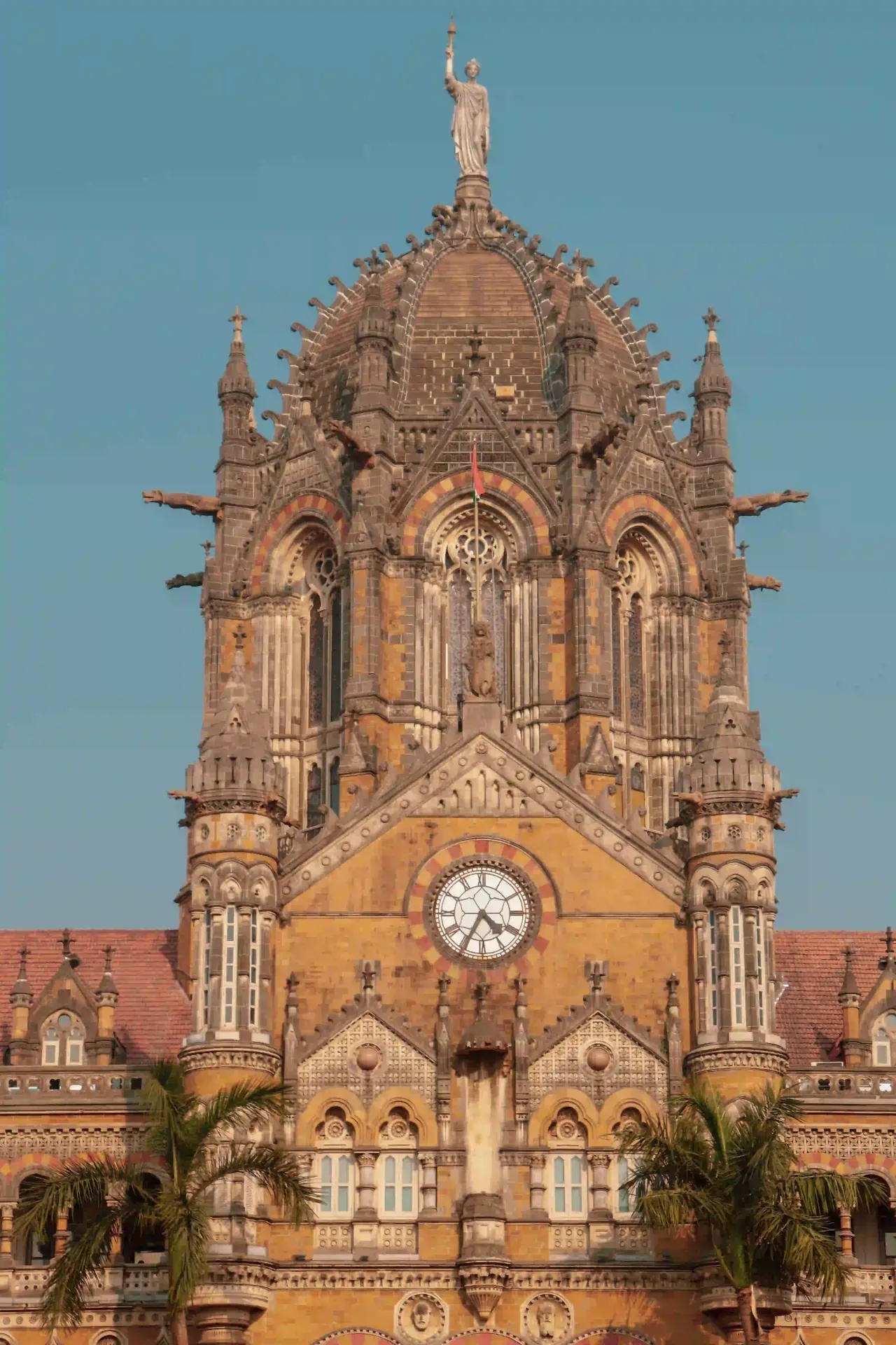
10 Days · Manali to Leh · Fully Supported

There is a road that begins at 2,050 metres above sea level in Manali and ends at 3,524 metres in Leh, crossing five high-altitude passes above 4,000 metres, skirting glaciers, river valleys, ancient Buddhist monasteries, and some of the most desolate and magnificent terrain on earth. It is called the Manali–Leh Highway. The only correct way to travel it is on a Royal Enfield — slowly, deliberately, and with someone beside you who has ridden it before. Includes 10 complimentary premium edited photographs.

Book via WhatsApp

Instant reply · Fully private · All logistics handled from Day 1
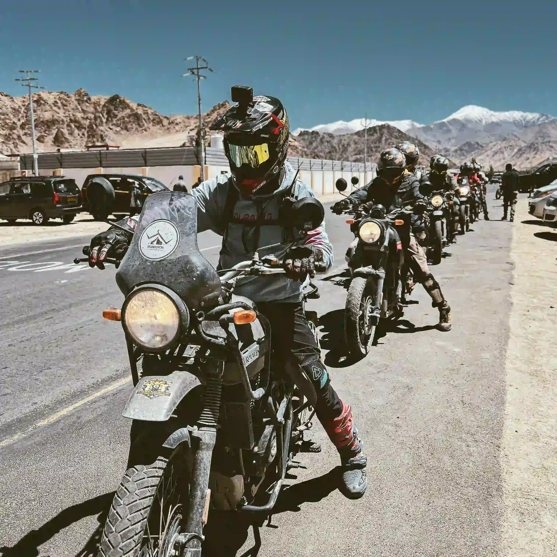
Royal Enfield riders on a Himalayan road in Ladakh
Fully Supported
  • Royal Enfield Himalayan 450
  • Mechanic & Support Vehicle
  • Hotel & Guesthouse Stays
  • 10 Edited Photographs
🧿
Royal Enfield 450Fully serviced machine
🏔
5 High PassesAbove 4,000 m altitude
🚗
Support VehicleMechanic & luggage daily
📷
10 Edited PhotosComplimentary premium
⏱
10 DaysManali → Leh

Ten Days Across The Roof of the World

The Manali–Leh Highway is 479 kilometres long. It passes through four distinct climate zones, five mountain passes, three river valleys, and terrain that no other road in India — and very few in the world — can match. Each day on this expedition is a chapter in itself.

01
Day 1 · Delhi → Manali · Overnight Volvo
Delhi Departure & Overnight Journey to Manali
The expedition begins at Delhi’s Kashmiri Gate ISBT bus terminus in the early evening. Your pre-booked luxury Volvo sleeper coach departs for Manali at approximately 5:30 PM — a 14-hour overnight journey through Himachal Pradesh that deposits you in the mountain town by early morning. The Volvo is the most comfortable way to make this crossing: reclining seats, air conditioning, a dramatic climb into the foothills of the Himalayas visible at dawn. Kamran meets you at Delhi and accompanies the group throughout. The support vehicle departs the same evening carrying all mechanical spares, tools, first-aid kit, and heavy luggage so riders travel light on the bikes from Day 2 onwards.
Overnight Volvo Included · Support Vehicle Departs Delhi
02
Day 2 · Manali · Rest & Acclimatisation · 2,050 m
Manali — Bike Briefing, Old Manali & Hadimba Temple
Arrival in Manali by 7:30 AM. Hotel check-in, hot breakfast, and the most important single day of the expedition: acclimatisation. You are already at 2,050 metres and the passes ahead begin at 3,978 metres. Rushing altitude is the single most common mistake of first-time Himalayan riders — and it is entirely avoidable. The morning is a full technical briefing on your Royal Enfield Himalayan 450: riding posture for mountain terrain, gear selection on steep gradients, brake technique on loose gravel and river crossings, and emergency procedures. The afternoon is a gentle orientation ride through the town, a visit to the ancient Hadimba Devi Temple (a 16th-century pagoda-style shrine built around a sacred cave in a deodar cedar forest), and a walk through the apple orchards and riverside cafes of Old Manali. The evening is a route briefing over dinner: every pass, every road condition, every contingency plan for the ten days ahead.
Altitude: 2,050 m · Bike Briefing · Route Planning Dinner
03
Day 3 · Manali → Keylong · 116 km · Via Rohtang Pass (3,978 m)
First Taste of Altitude — Rohtang Pass & the Lahaul Valley
The first riding day. Departure at 6:00 AM sharp — Rohtang Pass must be crossed before 10:00 AM, when the BRO (Border Roads Organisation) closes it to tourist traffic. The climb from Manali to Rohtang is 51 kilometres of progressively thinning air, switchback hairpins, and — even in summer — occasional snow fields beside the road. At 3,978 metres, Rohtang is the gateway between the green, temperate Kullu Valley and the high-altitude cold desert of Lahaul: the landscape changes visibly the moment you cross the pass. The descent into the Chandra River valley is one of the most technically demanding stretches of the highway — steep, loose, spectacular. Lunch at Gramphu, where the Chandra and Bhaga rivers meet, then a relatively straightforward 45 km through the Lahaul Valley to the overnight stop at Keylong (3,100 m), the administrative capital of Lahaul and Spiti. Evening at a local guesthouse: dinner, rest, and bike check with the mechanic.
Pass: Rohtang 3,978 m · Distance: 116 km · Guesthouse Overnight
04
Day 4 · Keylong → Patseo · 72 km · Via Baralacha La (4,890 m)
The Great Altitude Step — Baralacha La & Suraj Tal
The day the Himalayas become serious. Baralacha La at 4,890 metres is where riders first confront genuine high altitude — air that is noticeably thin, cold regardless of the season, and demanding of both the machine and the rider. The climb from Keylong passes through Jispa and Darcha — the last settlements before the true wilderness — and then ascends steeply through moraine, glacier melt streams, and terrain where nothing grows except the occasional patch of alpine grass. Just before the summit of Baralacha La, the road passes Suraj Tal — the third highest lake in India at 4,883 metres, fed entirely by glacial melt, its surface a vivid turquoise in summer that appears almost impossibly saturated against the grey scree and white snowfields above. The descent from Baralacha into the Lingti Plains is the first encounter with what Ladakh’s landscape will look like for the next four days: vast, brown, treeless, lunar, and one of the most beautiful things you have ever seen. Overnight at a tent camp or basic guesthouse at Patseo.
Pass: Baralacha La 4,890 m · Suraj Tal Lake · Distance: 72 km
05
Day 5 · Patseo → Sarchu → Leh (via Gata Loops & Nakee La & Lachulung La) · 109 km
The Gata Loops, Nakee La & Lachulung La — Three Passes in One Day
The most dramatic single day on the route. From Patseo, the road passes through Sarchu — a seasonal tent settlement at 4,290 metres that serves as a waypoint for those who need an extra night of acclimatisation. Then begins the Gata Loops: 21 hairpin bends carved into a steep mountain face, ascending 600 metres of altitude over 8 kilometres, each loop offering a wider panorama of the Lingti Plains falling away below. It is one of the most photographed stretches of road in India, and it earns that reputation. Above the Gata Loops, the road crosses Nakee La (4,739 m) and then Lachulung La (4,773 m) in quick succession — both relatively gentle passes compared to what came before, but at nearly 5,000 metres the air is thin enough to make even basic physical effort feel deliberate. The Morey Plains beyond Lachulung La are among the flattest high-altitude terrain on earth: a vast, silent plateau at 4,600 metres where marmots watch the road from their burrows. Overnight stay at Leh camp or hotel depending on group preference.
Gata Loops · Passes: Nakee La 4,739 m & Lachulung La 4,773 m · Morey Plains
06
Day 6 · Approach to Leh · Via Tanglang La (5,328 m) · 71 km
Tanglang La — The Highest Pass on the Highway
Tanglang La at 5,328 metres is the highest point on the Manali–Leh Highway and the second-highest motorable pass in the world. The summit sign reads: “You are passing through one of the highest passes in the world. Unacclimatised persons may suffer altitude sickness.” By Day 6 the group is fully acclimatised — but at over 5,000 metres the air contains roughly 54% of the oxygen available at sea level, and the cold at the summit is genuine regardless of summer sun below. The pass marks the point of no return: Leh is now closer than Manali. The descent from Tanglang La is long and sweeping, through a series of wide river valleys and small Ladakhi villages — flat-roofed white houses, chortens at the roadside, prayer flags snapping in the wind, apricot trees laden in summer — before the road widens and the army cantonment buildings of Leh’s outskirts appear. Check-in at a quality hotel in Leh. Hot shower. A proper dinner. The motorcycle has brought you 479 kilometres and 5,328 metres above the sea. Tomorrow: Leh itself.
Pass: Tanglang La 5,328 m · Highest Point on Route · Arrival Leh 3,524 m
07
Day 7 · Leh Town · Rest & Exploration · 3,524 m
Leh Palace, Shanti Stupa & Leh Old Town
A rest day in Leh — earned, essential, and extraordinary in its own right. The motorcycles are parked; today is on foot. Leh was for centuries the capital of the Kingdom of Ladakh, a Buddhist kingdom in the westernmost reaches of the Tibetan plateau that maintained its independence from Mughal, Sikh, and British pressure through trade, diplomacy, and the sheer impregnability of its mountain walls. The 17-storey Leh Palace — built in the 17th century by King Sengge Namgyal and predating the Potala Palace in Lhasa — dominates the old town from its ridge. The climb up through the narrow lanes of the bazaar to the palace offers views over the Indus Valley floor and the Zanskar Range beyond that no road can replicate. Shanti Stupa, the Japanese-funded white stupa on the opposite ridge, is best visited at sunset. The Leh market — Tibetan jewellery, pashmina, butter tea, dried apricots, prayer wheels — is an afternoon in itself. Kamran accompanies and contextualises the entire day: the history of the Namgyal dynasty, the meeting of Tibetan Buddhism and Ladakhi culture, and the extraordinary fact that this city existed in complete isolation for most of recorded history.
Rest Day · Leh Palace · Shanti Stupa · Leh Old Market
08
Day 8 · Leh → Pangong Tso · Via Chang La (5,360 m) · 155 km Return
Pangong Lake — The Highest Saltwater Lake on Earth
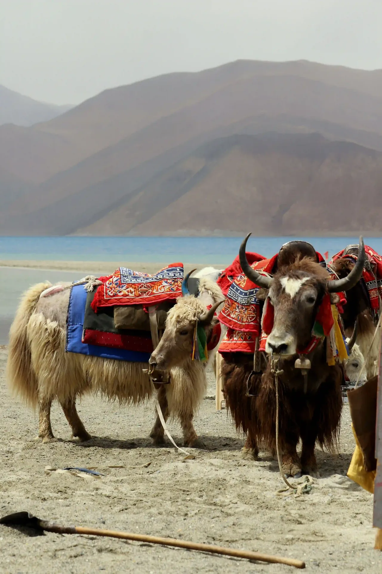
The ride that defines the expedition for most riders. Chang La at 5,360 metres is — depending on the season and which measurement is current — either the second or third highest motorable pass in the world. The approach from Leh climbs through the Changthang Plateau, a high-altitude cold desert inhabited only by nomadic Changpa herders and their yaks. And then, after the descent from Chang La through a winding river gorge, Pangong Tso appears. The lake is 134 kilometres long — roughly the length of the drive from London to Oxford and back — and sits at 4,225 metres altitude. Its colour is a blue so improbable, so intensely saturated, that the first reaction of almost every visitor is to disbelieve it. The deepest cobalt blue in the centre, shading to turquoise at the edges, surrounded by brown desert hills and snow peaks. Sixty percent of the lake lies in Chinese-controlled territory; the remaining forty percent in India. There is no fence. The border is unmarked in the water. The group spends two hours on the western shore, with Kamran explaining the geopolitics, the ecology, and the extraordinary sensory experience of standing beside the most beautiful body of water in Asia. Photographs are taken — this is the day your 10 complimentary premium edited photographs include.
Pass: Chang La 5,360 m · Pangong Tso 4,225 m · Photography Day
09
Day 9 · Leh → Thiksey, Hemis & Magnetic Hill · ~80 km Loop
The Indus Valley Circuit — Monasteries, the Confluence & The Magnetic Hill
The last riding day before departure, and the most culturally dense. The Indus Valley circuit southeast of Leh follows the river through a sequence of monasteries, villages, and natural landmarks that represent the full depth of Ladakhi Buddhist civilisation. Thiksey Gompa: a 12-storey monastery complex built into a cliff face above the Indus, its red-and-white walls and golden rooftop temples visible for miles. Inside, a 15-metre gold Maitreya Buddha (the Future Buddha) sits in a chamber that opens across two floors — one of the most arresting single objects in the Himalayas. Hemis Gompa: the wealthiest and largest monastery in Ladakh, hidden in a narrow gorge 45 kilometres from Leh, famous for its June Hemis Festival (masked Cham dances) and its collection of thangkas, some reportedly the size of a multi-storey building. Sangam: the confluence of the Zanskar and Indus rivers — the greenish-blue Zanskar meets the muddy brown Indus in a swirling, visible meeting that is among the most dramatic river confluences in the world. The Magnetic Hill: an optical illusion on the Srinagar–Leh Highway where the road appears to ascend but vehicles in neutral actually roll “uphill.” Evening in Leh — final bike check, packing, and a farewell dinner.
Thiksey · Hemis · Zanskar-Indus Confluence · Farewell Dinner
10
Day 10 · Leh → Delhi · Return Flight
Kushok Bakula Rimpochee Airport & Photo Delivery
Departure from Kushok Bakula Rimpochee Airport — Leh’s airport at 3,256 metres is one of the highest commercial airports in the world, its runway carved from the Indus floodplain with the Stok Kangri massif (6,153 m) rising directly behind the terminal. Flights to Delhi operate in the early morning (typically 6:00–8:00 AM) while the air is cold and dense enough for safe operation — by midday, the thin high-altitude air frequently makes operations impossible. Kamran delivers your 10 complimentary premium edited photographs directly to your WhatsApp before you board — professionally composed, colour-graded images from Rohtang Pass, Suraj Tal, the Gata Loops, Tanglang La, Pangong Tso, and the Indus Valley monasteries. You arrive back in Delhi by mid-morning. Ten days, 479 kilometres of the greatest road on earth, five passes above 4,000 metres, and a landscape that does not resemble anywhere else on the planet. The Royal Enfield brought you through all of it.
Early Morning Flight Leh → Delhi · 10 Premium Photos Delivered via WhatsApp

Inclusions & Exclusions

✅ Package Inclusions

  • Royal Enfield Himalayan 450 (Fully Serviced): One Royal Enfield Himalayan 450 per rider for the full 10-day expedition. Pre-expedition full service, oil change, tyre check, brake inspection, and 24-hour mechanical support throughout the route.
  • Support Vehicle with Mechanic (Full Route): A dedicated 4×4 support vehicle carrying all mechanical spares, tools, first-aid kit, oxygen cylinder, and luggage. Travels the entire route parallel to riders, available at every pass and camp.
  • Overnight Volvo Delhi → Manali: Pre-booked luxury Volvo sleeper coach from Delhi (Kashmiri Gate ISBT) to Manali on Day 1. Most comfortable way to make the Himalayan approach.
  • Return Flight Leh → Delhi (Day 10): Pre-booked return flight from Kushok Bakula Rimpochee Airport, Leh to Delhi on Day 10. Economy class; business upgrade available on request.
  • All Accommodation (9 Nights): 9 nights of accommodation along the route: guesthouses, camp tents, and a quality hotel in Leh (3 nights). All meals at accommodation points included (breakfast and dinner).
  • Government Licensed Bilingual Guide (Full Expedition): Kamran Khan in English and Spanish for the entire 10-day expedition. Pan-India IITG licence. Route expertise, cultural context, monastery commentary, and altitude management guidance throughout.
  • Inner Line & Protected Area Permits: All required permits for non-Indian passport holders to ride into restricted Ladakhi areas including the Pangong Tso zone. Arranged and carried by Kamran throughout.
  • Riding Gear (Helmet, Jacket & Gloves): Full-face helmet, riding jacket with CE-rated armour, and riding gloves provided for each rider. Knee guards and balaclava also available on request. Own gear welcome.
  • Oxygen Cylinder & First Aid Kit: Portable oxygen cylinder in the support vehicle at all times. Full first-aid kit including Diamox (acetazolamide) for altitude sickness, Dexamethasone, and emergency medications. Kamran is trained in high-altitude first response.
  • 10 Complimentary Premium Edited Photographs: Professionally composed and post-processed photographs from key moments: Rohtang Pass, Suraj Tal, Gata Loops, Tanglang La, Pangong Tso, and monastery visits. Delivered via WhatsApp before the Day 10 Leh departure.

✕ Package Exclusions

  • Lunch on Riding Days: Lunches during riding days (Days 3–6, Day 8–9) are not included. Kamran identifies roadside dhabas and rest stops; costs are paid directly. Basic meals are universally available and typically inexpensive.
  • Delhi → Manali Upgrade (Flight Option): The package includes an overnight Volvo coach. Riders preferring to fly Delhi–Bhuntar (Kullu) + taxi to Manali can request this as a paid upgrade on booking.
  • Fuel Costs: Royal Enfield fuel for the full route is not included. The Himalayan 450 averages approximately 35 km/litre; total route fuel cost for 479 km is typically INR 2,500–3,500 per rider depending on current petrol prices.
  • Personal Travel Insurance: Strongly recommended and mandatory for all foreign passport holders. Must include adventure sports and high-altitude trekking/riding cover. Kamran can recommend reputable insurers on booking.
  • Alcoholic Beverages: Note: alcohol is prohibited above certain altitudes on this route and is strongly inadvisable given the altitude demands on the body. Any beverages beyond water, chai, and juice during the expedition are at rider expense.
  • Personal Expenses & Souvenirs: Thangkas, Tibetan jewellery, pashmina, prayer flags, and monastery donation boxes. Ladakh’s craft market in Leh is extraordinary; budget accordingly.
  • Gratuities: Optional and entirely at rider discretion for the mechanic, driver, and guesthouse hosts along the route.

What Makes This Different

01
Fully Supported, Not Solo
Every Royal Enfield expedition has a mechanic 4×4 following the entire route. Mechanical failure on Baralacha La at 4,890 metres is not a catastrophe on this trip — it is a managed inconvenience. The support vehicle carries your luggage so the bike handles as it was designed to in mountain terrain: light, responsive, and without a top-heavy load.
02
Altitude Management Protocol
Kamran has crossed these passes over 200 times. The itinerary is structured around medically sound acclimatisation principles: a full rest day in Manali before riding, gradual daily altitude gain, mandatory rest days in Leh, and an oxygen cylinder and Diamox in the support vehicle at all times. No rider has ever required medical evacuation on this expedition.
03
The Royal Enfield Himalayan 450
Not every motorcycle is suited to this route. The Himalayan 450 — Royal Enfield’s purpose-built adventure motorcycle with a 452 cc single-cylinder liquid-cooled engine, 21-inch front wheel, and long-travel suspension — was designed specifically for high-altitude mountain roads. It is neither the fastest nor the largest bike in India, but it is the most correct one for this road.
04
Pangong Tso — The Reason Everyone Comes
The Pangong Lake on Day 8 is the single most visually impactful moment on the Manali–Leh circuit. Arriving by motorcycle — having crossed Chang La at 5,360 metres to get there — rather than by tourist jeep is a fundamentally different experience. You have earned it. The 10 complimentary photographs are taken here.
05
Bilingual Expert Narrative
The Manali–Leh Highway passes through three distinct civilisational layers: Hinduism in Kullu, Tibetan Buddhism in Lahaul and Ladakh, and the strategic presence of the Indian military in one of the world’s most contested border regions. Kamran explains all three — in English and Spanish — as you ride through each.
06
No Experience Required — Riders Welcome
The Himalayan 450 is a forgiving, upright, confidence-inspiring motorcycle. The expedition is designed for riders with a basic motorcycle licence and some highway riding experience — off-road expertise is not required. The technical briefing on Day 2 covers everything specific to mountain riding. Riders who have never left tarmac regularly complete this route.

Practical Details

Duration
10 Days — Delhi to Delhi
Day 1 departs Delhi evening. Day 10 returns to Delhi mid-morning via Leh flight. No additional leave days required beyond 10 calendar days.
Group Size
1 to 6 Riders
Entirely private — your group only. Larger groups (7–12 riders) available on request with an additional support vehicle and assistant guide.
Languages
English & Spanish
Hindi and Urdu also available. In-ear bluetooth intercom systems available for rider-to-guide communication at high-altitude passes.
Best Season
June — September
The Manali–Leh Highway is typically open from mid-June to mid-October. Rohtang Pass opens when BRO clears snow — usually late May or early June. The highway closes in winter (November–May) due to heavy snowfall. July–August offers the most reliable road conditions; late August into September offers the thinnest crowds and most stable weather.
Physical Requirements
Moderate fitness · Valid motorcycle licence
A valid motorcycle licence is required. Reasonable physical fitness is necessary — 6–8 hours of riding per day across multiple days at altitude. Riders with heart conditions, severe respiratory problems, or uncontrolled hypertension should consult a physician before booking. Prior high-altitude experience is an advantage but not a requirement.
Availability
June – September · Fixed Departure Dates
Departures operate on fixed weekly dates through the riding season. Contact Kamran via WhatsApp for current available dates and to confirm the next departure window.
Meeting Point
Kashmiri Gate ISBT — Delhi
Day 1 assembly at Kashmiri Gate Inter-State Bus Terminal, Delhi. Hotel pickup across Delhi NCR also available on request. Share your hotel address via WhatsApp — Kamran arranges the rest.
What to Bring — Items to Carry
Complete Packing List for the Expedition
Riding Gear (if bringing your own): Full-face helmet (half-face not recommended above 4,000 m due to cold and stones). Riding jacket with CE-rated armour — waterproof outer, insulated liner. Riding trousers with knee and hip protection. Waterproof riding gloves (one light pair for lower sections; one heavy insulated pair for passes above 4,500 m). Ankle-covering riding boots. Balaclava or neck gaiter for summit crossings. Sunglasses and/or goggles (reflected UV off snow at altitude is intense). Knee guards as a backup layer under trousers. Clothing (off-bike): Thermals (top and bottom) — one heavyweight set minimum. Mid-layer fleece or down jacket. Waterproof outer shell (rain and wind). 3–4 sets of base-layer t-shirts and underwear. 2 pairs of trekking trousers or jeans. Warm socks (wool preferred) — 4–5 pairs. Light shoes or sandals for guesthouse evenings. Sun hat for lower-altitude day riding. Warm beanie/wool hat for camp nights at altitude. Essentials & Medications: Valid motorcycle licence and passport (originals carried; photocopies in luggage). Inner Line Permit — arranged by Kamran, but carry your own copy. Prescription medications for the full duration plus 3 extra days. Diamox (acetazolamide) — discuss with your GP before travel; expedition stock available in support vehicle. SPF 50+ sunscreen — UV intensity at altitude is extreme. SPF lip balm. Moisturising cream for high-altitude dryness. Personal first-aid: blister plasters, ibuprofen, antihistamine, rehydration sachets. Hand sanitiser and wet wipes for roadside stops. Small padlock for guesthouse storage. Electronics & Documents: Power bank (2 recommended — phone charging at guesthouses can be unreliable). Universal travel adapter. Earphones or in-ear bluetooth intercom for pass communication. Camera or use your smartphone (10 edited photos are taken by Kamran’s photographer). Waterproof phone case or dry bag. Emergency contact list in printed form. Travel insurance document printed and digital. Luggage Strategy: All heavy luggage (sleeping bag if preferred, extra clothing, boots) travels in the support vehicle. Riders carry only a small tank bag or tail bag on the bike: valuables, camera, sunscreen, snacks, and a light layer. Pack total luggage to fit one mid-size duffel or soft bag (70–80 litres) for the support vehicle, plus one small day bag for the bike. Hard suitcases are not recommended.
Reserve Your Expedition
Himalayan Royal Enfield Expedition
  • Royal Enfield Himalayan 450 (fully serviced)
  • Support vehicle with mechanic — full route
  • Overnight Volvo Delhi → Manali & return flight Leh → Delhi
  • 9 nights accommodation (guesthouses + Leh hotel)
  • All riding gear (helmet, jacket, gloves)
  • Government-licensed bilingual guide — 10 days
  • All permits (Inner Line & Protected Area)
  • 10 complimentary premium edited photographs
Book via WhatsApp ← Back to Main Website
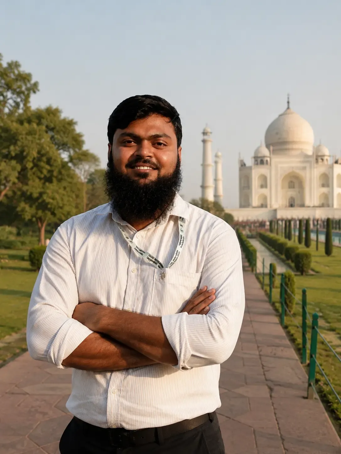
Kamran Khan, government-licensed tour guide, standing in front of the Taj Mahal
IITG Govt. Licensed

Kamran Khan

I have crossed Tanglang La over 200 times. The first time, I was 24 years old and the road was worse, the bikes were older, and there was no mobile signal from Gramphu to Leh. Some things have improved. The mountains have not changed. And the feeling at the summit — when the engine is struggling with the thin air and the road ahead disappears into a sky that is a darker blue than you have ever seen from the ground — that has not changed either.

I hold a Government Pan-India IITG licence — the highest certification in Indian tourism. For over a decade I have guided travellers from more than 40 nationalities through the Himalayas, trained in high-altitude first response, and led expeditions without a single medical evacuation. The safety record is not luck. It is protocol, preparation, and knowing when to stop.

The Manali–Leh Highway is the road I know best in India. Not because it is the most technically demanding — though it is — but because it is the one that changes the people who ride it the most. Ten days from now, you will not see altitude, distance, or silence the same way again. That is always the goal.

English Español हिन्दी اردو